B.C. Floods 2021

Cache Creek overflowed the culvert at Quartz Road on the evening of April 29, prompting the village to declare a State of Local Emergency and place one property east of the site on evacuation order. (Photo credit: Barbara Roden)

Flooding prompts state of local emergency in Cache Creek

One property has been placed on evacuation order

Cache Creek overflowed the culvert at Quartz Road on the evening of April 29, prompting the village to declare a State of Local Emergency and place one property east of the site on evacuation order. (Photo credit: Barbara Roden)
The Fraser River is seen between Hope and Agassiz, B.C., on Monday, July 6, 2020. Parts of British Columbia’s Interior region remain under a flood watch as warm weather over the weekend melted snow and more rain is forecast in some communities. THE CANADIAN PRESS/Darryl Dyck

Some communities in B.C.’s interior remain on flood watch with rain in the forecast

Several Interior communities in B.C. expecting to see rain Monday

The Fraser River is seen between Hope and Agassiz, B.C., on Monday, July 6, 2020. Parts of British Columbia’s Interior region remain under a flood watch as warm weather over the weekend melted snow and more rain is forecast in some communities. THE CANADIAN PRESS/Darryl Dyck
Jeff Moore, the Cowichan Valley Regional District’s senior environmentalist, at one of the many information boards during a flood mitigation planning session at the Crofton Community Centre last July. (Photo by Don Bodger)

Chemainus River flood mapping project receives funding approval

CVRD’s efforts yield $510,500 from joint provincial-federal program

Jeff Moore, the Cowichan Valley Regional District’s senior environmentalist, at one of the many information boards during a flood mitigation planning session at the Crofton Community Centre last July. (Photo by Don Bodger)
The flooded Mississippi River surrounds the homes on Abel Island near Guttenberg, Iowa, on Tuesday, April 25, 2023. (Stephen Gassman/Telegraph Herald via AP)

Mississippi River flooding prompts evacuations, sandbagging

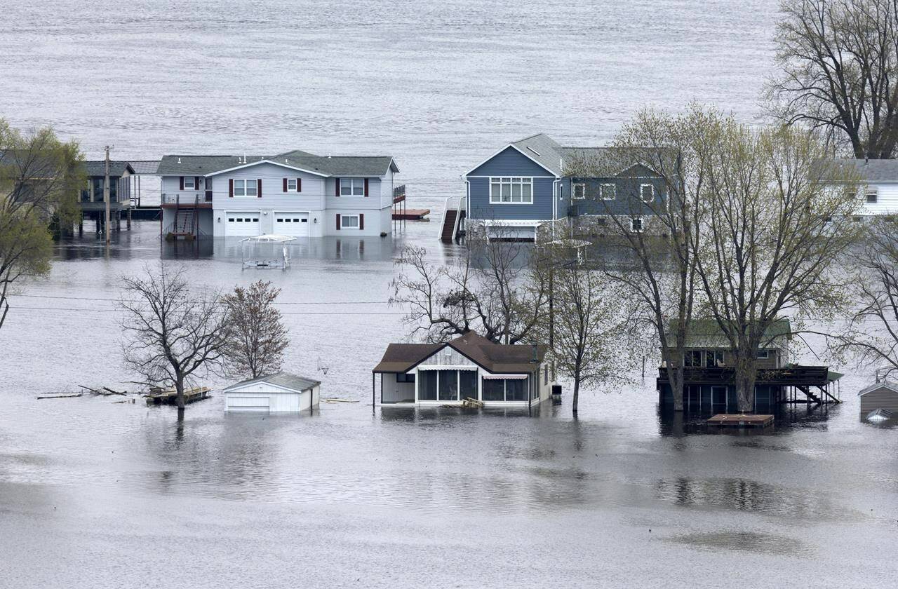
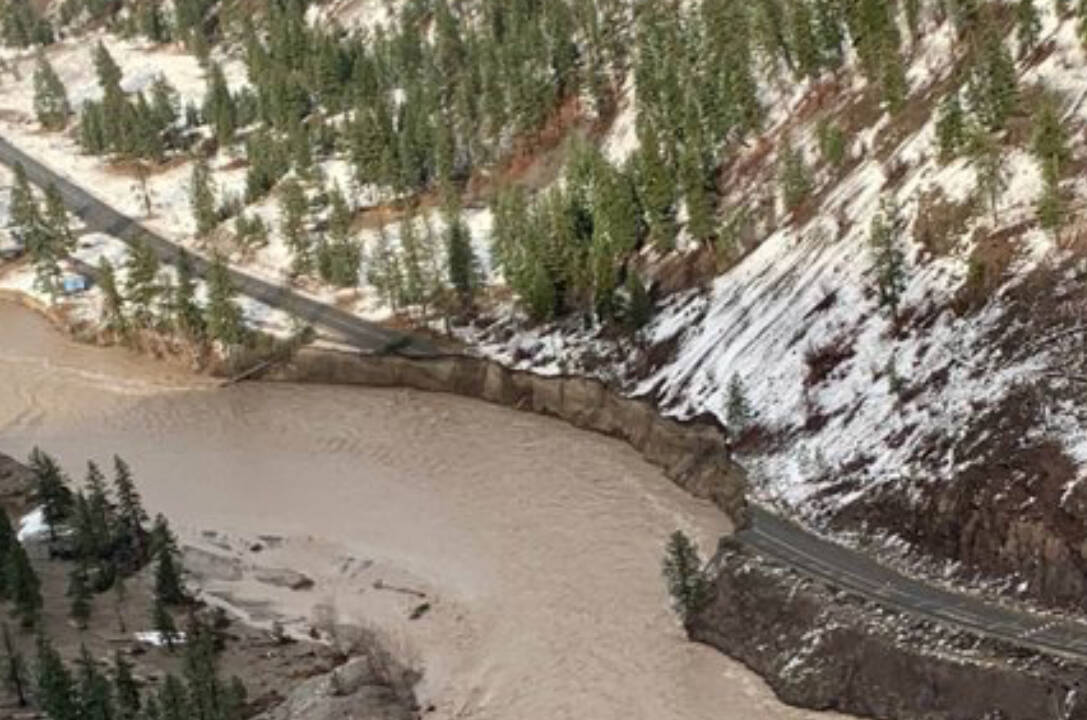
Huge snowpack that began to quickly melt leading to near-record river levels

The flooded Mississippi River surrounds the homes on Abel Island near Guttenberg, Iowa, on Tuesday, April 25, 2023. (Stephen Gassman/Telegraph Herald via AP)
Flooding in fall 2021 caused massive to the provincial infrastructure including Highway 8 along the Nicola River near Merritt. Current snow-pack levels are at seasonal norms across the province, but other parts are above seasonal norms. (BC Transportation/Twitter)

Some parts of B.C.’s Interior face spring flooding risk: River Forecast Centre

Snow pack level for entire province, including Lower Fraser River, at normal seasonal levels

Flooding in fall 2021 caused massive to the provincial infrastructure including Highway 8 along the Nicola River near Merritt. Current snow-pack levels are at seasonal norms across the province, but other parts are above seasonal norms. (BC Transportation/Twitter)
Abbotsford Mayor Ross Siemens speaks during a press conference on Feb. 23, flanked by Emergency Preparedness Minister Bill Blair (left) and Taleeb Noormohamed, MP for Vancouver Granville and Chair of the Liberal Pacific Caucus Chair. (Photo: City of Abbotsford)

Federal disaster aid program for 2021 B.C. floods now tops $1 billion

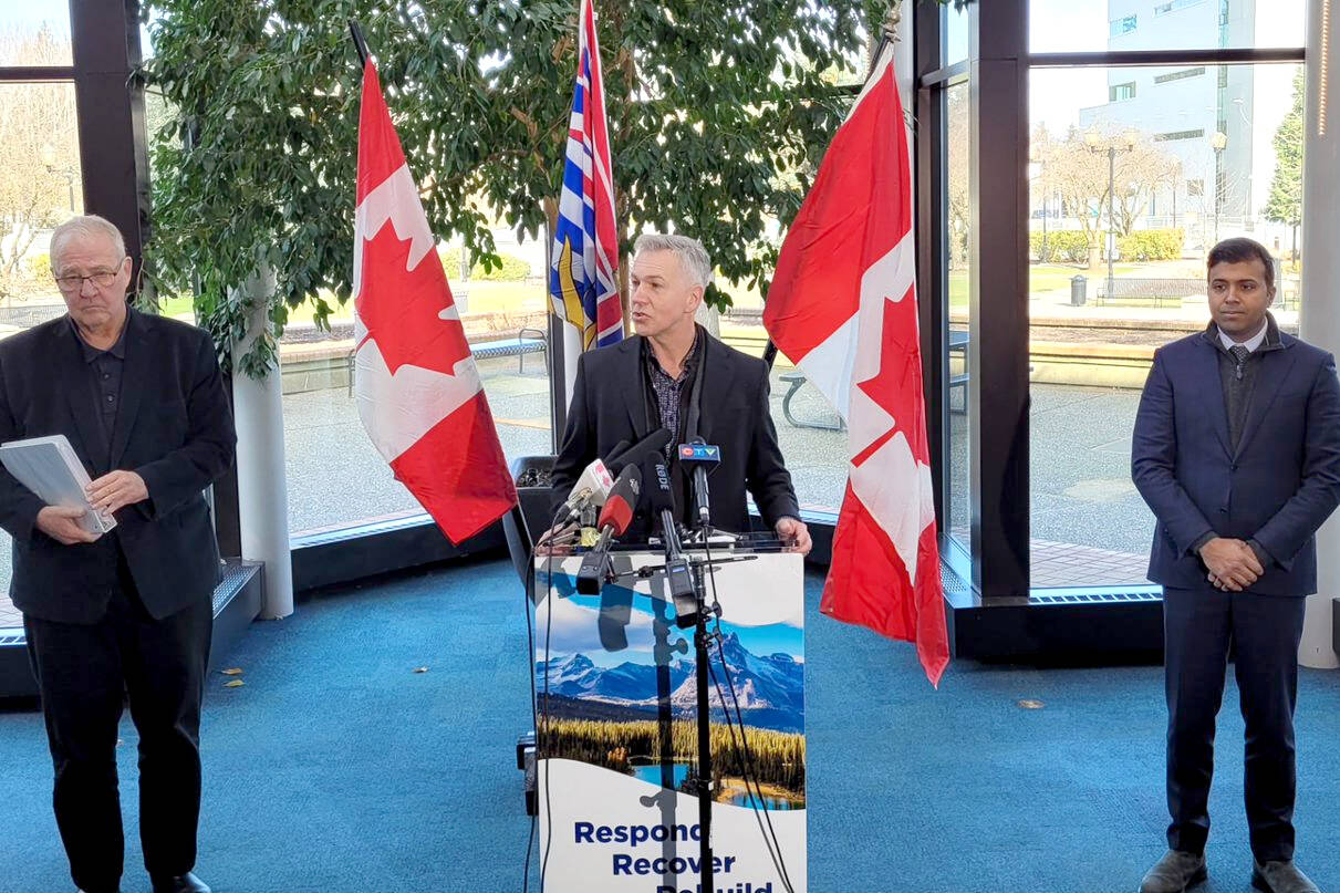
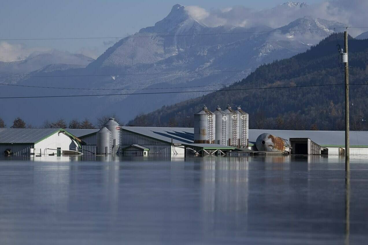
Today’s announcement in Abbotsford is for $557 million, the second payment installment

Abbotsford Mayor Ross Siemens speaks during a press conference on Feb. 23, flanked by Emergency Preparedness Minister Bill Blair (left) and Taleeb Noormohamed, MP for Vancouver Granville and Chair of the Liberal Pacific Caucus Chair. (Photo: City of Abbotsford)
FILE - Tents are set up for climbers on the Khumbu Glacier, with Mount Khumbutse, center, and Khumbu Icefall, right, seen in background, at Everest Base Camp in Nepal on April 11, 2015. As glaciers melt and pour massive amounts of water into nearby lakes, 15 million people across the globe live under the threat of a sudden and deadly outburst flood, a new study finds. (AP Photo/Tashi Sherpa, File)

15 million people around the world live under threat of glacial floods: study

It’s a threat Americans and Europeans rarely think about

FILE - Tents are set up for climbers on the Khumbu Glacier, with Mount Khumbutse, center, and Khumbu Icefall, right, seen in background, at Everest Base Camp in Nepal on April 11, 2015. As glaciers melt and pour massive amounts of water into nearby lakes, 15 million people across the globe live under the threat of a sudden and deadly outburst flood, a new study finds. (AP Photo/Tashi Sherpa, File)
In this image provided by the Philippine Coast Guard, an elderly woman sits on a chair while being carried by coast guard personnel wading through floodwaters in Plaridel, Misamis Occidental province in the southern Philippines, Monday, Dec. 26, 2022. Heavy rains and floods devastated parts of the Philippines over the Christmas weekend. (Philippine Coast Guard via AP)

Floods in Philippines leave 51 dead, over a dozen missing

Over 4,500 houses were damaged by the floods, along with roads and bridges

In this image provided by the Philippine Coast Guard, an elderly woman sits on a chair while being carried by coast guard personnel wading through floodwaters in Plaridel, Misamis Occidental province in the southern Philippines, Monday, Dec. 26, 2022. Heavy rains and floods devastated parts of the Philippines over the Christmas weekend. (Philippine Coast Guard via AP)
People walk along the Stanley Park seawall as rain falls Sunday, Dec. 25, 2022, while a small amount of snow remains after last week’s snowstorm in Vancouver. Flood watches and high streamflow advisories are posted across Vancouver Island and much of British Columbia’s inner south coast as heavy rain and high tides raise the risk of flooding after pre-Christmas snowstorms. THE CANADIAN PRESS/Darryl Dyck

Rain, run-off from recent snow, surging tides raise flood concerns in parts of B.C.

Flood watches in effect for Lower Mainland, Vancouver Island

People walk along the Stanley Park seawall as rain falls Sunday, Dec. 25, 2022, while a small amount of snow remains after last week’s snowstorm in Vancouver. Flood watches and high streamflow advisories are posted across Vancouver Island and much of British Columbia’s inner south coast as heavy rain and high tides raise the risk of flooding after pre-Christmas snowstorms. THE CANADIAN PRESS/Darryl Dyck
This is how Pinson’s Corner looked Tuesday morning. (Photo by Don Bodger)

Receding waters allow Chemainus and Crofton Roads to reopen

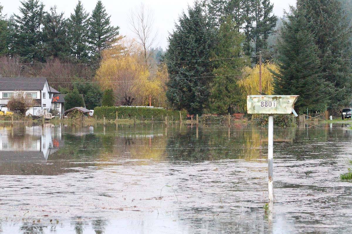
King tide and heavy rains don’t result in an elevated flood

This is how Pinson’s Corner looked Tuesday morning. (Photo by Don Bodger)
The Pinson’s Road area of Chemainus and Crofton Roads has been closed due to flooding. (Photo by Don Bodger)

Numerous Chemainus, Crofton Road properties under Evacuation Alert

King tide, heavy rain and melting snow create a perfect storm for rising waters

The Pinson’s Road area of Chemainus and Crofton Roads has been closed due to flooding. (Photo by Don Bodger)
A hiker passes through along a trail amidst a grove of poplar trees at the Rouge Urban National Park, in Toronto, Tuesday, June 15, 2021. The federal environment minister is warning that Ottawa will not provide disaster compensation where a province deliberately allows housing to be built in areas prone to flooding. THE CANADIAN PRESS/Giordano Ciampini

Feds won’t help provinces for disaster compensation if housing built in flood areas

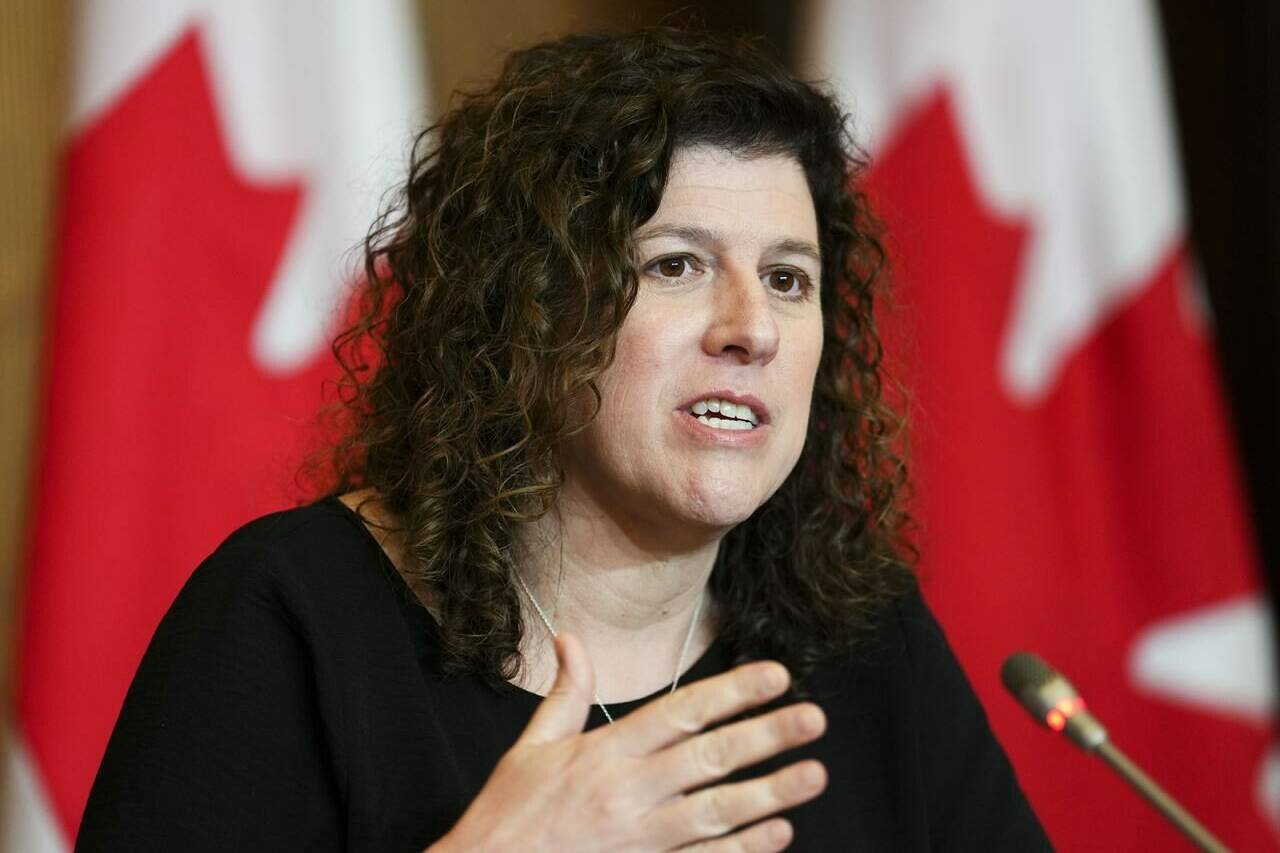
Environment minister’s comments come after Ontario reveals plans to build in ‘Greenbelt’

A hiker passes through along a trail amidst a grove of poplar trees at the Rouge Urban National Park, in Toronto, Tuesday, June 15, 2021. The federal environment minister is warning that Ottawa will not provide disaster compensation where a province deliberately allows housing to be built in areas prone to flooding. THE CANADIAN PRESS/Giordano Ciampini
The Raincoast Conservation Foundation led a study of contaminants in the water of the Sumas Lake area following the November 2021 floods. The findings were released Thursday, Nov. 17, 2022. (Alex Harris/Raincoast Conservation Foundation)

Painkillers, pesticides and cocaine among contaminants found in Fraser Valley floodwaters

Study of water samples raises ‘fundamental questions’ about health of people and fish

The Raincoast Conservation Foundation led a study of contaminants in the water of the Sumas Lake area following the November 2021 floods. The findings were released Thursday, Nov. 17, 2022. (Alex Harris/Raincoast Conservation Foundation)
Auditor General of Canada Karen Hogan holds a press conference following the tabling of the AG report in Ottawa on Tuesday, May 31, 2022. THE CANADIAN PRESS/Sean Kilpatrick

Auditor general says Canada failing First Nations in response to wildfires, floods

Report says department too reactive, instead of spending on infrastructure to mitigate damages

Auditor General of Canada Karen Hogan holds a press conference following the tabling of the AG report in Ottawa on Tuesday, May 31, 2022. THE CANADIAN PRESS/Sean Kilpatrick
Shackan Indian Band Chief Arnold Lampreau. (Jake Courtepatte/Capital News)

Thompson-Nicola Indigenous bands still reeling from flood that destroyed highway

About 20 hectares of agricultural land lost to November 2021 flood

Shackan Indian Band Chief Arnold Lampreau. (Jake Courtepatte/Capital News)
A farm submerged by flood waters caused by heavy rains and mudslides earlier in the week is pictured in the Sumas Prairies near Chilliwack, B.C., Friday, Nov. 19, 2021. British Columbia’s agriculture minister says farmers in the Sumas Prairies had “an emotional year” as they work to recover following the province’s catastrophic flooding last November. THE CANADIAN PRESS/Jonathan Hayward

B.C. agriculture minister says sector is recovering well on flooding anniversary

About 630,000 chickens, 420 cattle and 12,000 hogs died in Sumas Prairie during flooding a year ago
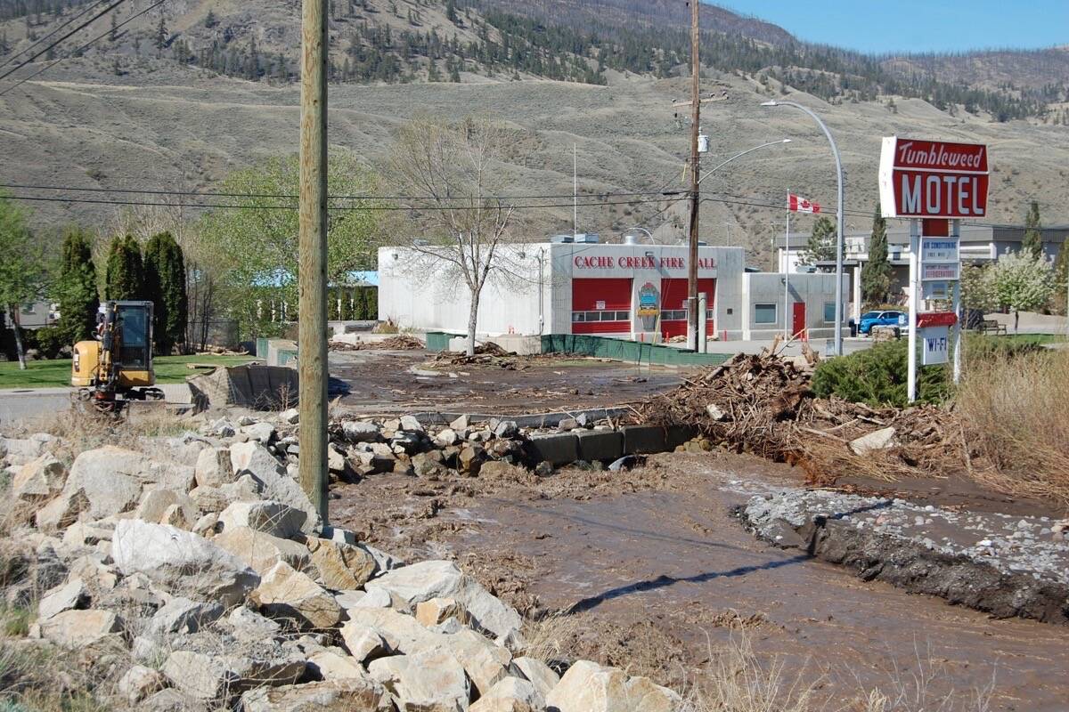
A farm submerged by flood waters caused by heavy rains and mudslides earlier in the week is pictured in the Sumas Prairies near Chilliwack, B.C., Friday, Nov. 19, 2021. British Columbia’s agriculture minister says farmers in the Sumas Prairies had “an emotional year” as they work to recover following the province’s catastrophic flooding last November. THE CANADIAN PRESS/Jonathan Hayward
Ships in the Marine Transportation Services shipyard are shown in Hay River, N.W.T., on Wednesday, Oct. 26, 2022. Marine Transportation Services is owned by the N.W.T. government and provides barging services for locations along the Mackenzie River and in the western Arctic. THE CANADIAN PRESS/Emily Blake
A map of the new bypass. (Courtesy of Dididaht First Nation)
Flooding on a rural home in the Hatzic community taken on Nov. 29, 2021, a day before the third atmospheric river event. (Black Press Media file photo)

B.C. communities warned to prepare for flooding when rain hits drought-ridden areas

Dry weather can increase initial flood risk, River Forecast Centre says

Flooding on a rural home in the Hatzic community taken on Nov. 29, 2021, a day before the third atmospheric river event. (Black Press Media file photo)
This is a locator map for Pakistan with its capital, Islamabad, and the Kashmir region. (AP Photo)

UN tells world to speed up response for flood-hit Pakistan

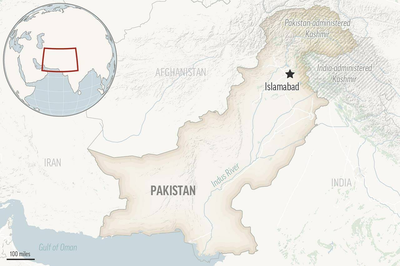
Monsoons have left at least 1,700 people dead and wiped out infrastructure

This is a locator map for Pakistan with its capital, Islamabad, and the Kashmir region. (AP Photo)