bcwildfire

The West Kiskatinaw River wildfire (G70645) burns in the District of Tumbler Ridge, B.C. in this Thursday, June 8, 2023 handout image provided by the BC Wildfire Service. THE CANADIAN PRESS/HO, BC Wildfire Service *MANDATORY CREDIT*

Winds fan northeast B.C. wildfire, but aid crews working to save Tumbler Ridge

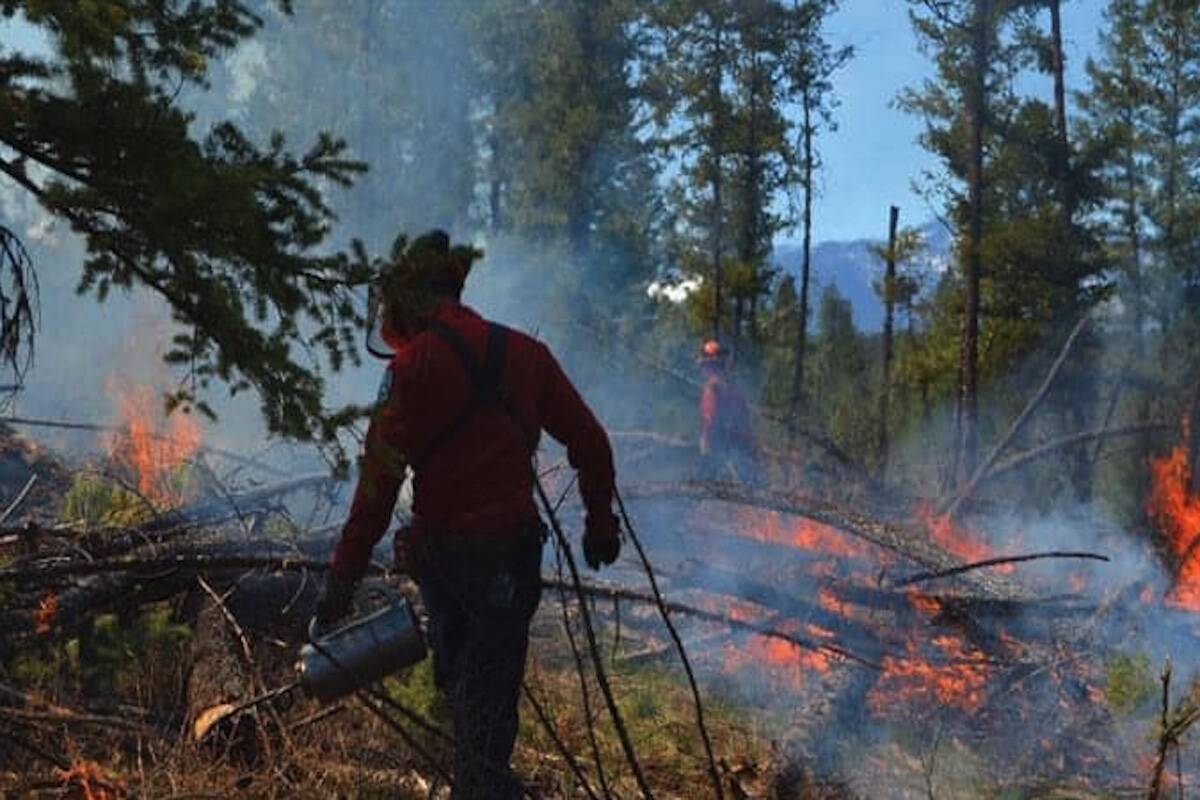
5 wildfires of note are among more than 80 blazes throughout B.C.

The West Kiskatinaw River wildfire (G70645) burns in the District of Tumbler Ridge, B.C. in this Thursday, June 8, 2023 handout image provided by the BC Wildfire Service. THE CANADIAN PRESS/HO, BC Wildfire Service *MANDATORY CREDIT*
A Columbia Fuels truck winds its way along the detour route between Lake Cowichan and the Bamfield Main logging road as Highway 4 is closed due to a wildfire at Cameron Bluffs. Bringing fuel trucks into Port Alberni and the West Coast remains a challenge, according to the ACRD’s Emergency Operations Centre. (B.C. MINISTRY OF TRANSPORTATION PHOTO)

Pilot cars to escort convoys of food, fuel trucks around Highway 4 detour

Drivers are asked to limit use of detour from Port Alberni to allow movement of essential goods

A Columbia Fuels truck winds its way along the detour route between Lake Cowichan and the Bamfield Main logging road as Highway 4 is closed due to a wildfire at Cameron Bluffs. Bringing fuel trucks into Port Alberni and the West Coast remains a challenge, according to the ACRD’s Emergency Operations Centre. (B.C. MINISTRY OF TRANSPORTATION PHOTO)
A food truck belonging to Quality Foods drives ailong the detour route between Lake Cowichan and Port Alberni to deliver goods on Friday, June 9, 2023. (B.C. MINISTRY OF TRANSPORTATION PHOTO)

Cameron Bluffs fire near Port Alberni grows to 208 hectares; Highway 4 remains closed

B.C. Premier Eby faces criticism over not opening Horne Lake connector as second route

A food truck belonging to Quality Foods drives ailong the detour route between Lake Cowichan and Port Alberni to deliver goods on Friday, June 9, 2023. (B.C. MINISTRY OF TRANSPORTATION PHOTO)
A wildfire which started in the afternoon of May 29 west of Sayward has spread to approximately 90 hectares overnight due to high winds. Photo Courtesy Rachel Boult/Facebook
A wildfire which started in the afternoon of May 29 west of Sayward has spread to approximately 160 hectares since it started on the afternoon of May 29. Photo Courtesy Rachel Boult/Facebook

UPDATE: Sayward Fire still not contained as it spreads to 160 hectares

Fire, believed to be human caused, started in the afternoon May 29.

A wildfire which started in the afternoon of May 29 west of Sayward has spread to approximately 90 hectares overnight due to high winds. Photo Courtesy Rachel Boult/Facebook
A wildfire which started in the afternoon of May 29 west of Sayward has spread to approximately 160 hectares since it started on the afternoon of May 29. Photo Courtesy Rachel Boult/Facebook
The BC Wildfire Service continues to respond to the Cameron River wildfire (G80175) located approximately 74 kilometres northwest of Fort St. John. As shown in this recent handout image. THE CANADIAN PRESS/HO-BC Wildfire Service

Easing winds aid wildfire fight, after ‘controlled chaos’ in Fort St. John, B.C.

Winds reaching 61 kilometres per hour blew dark smoke over the city, but patches of sky now visible

The BC Wildfire Service continues to respond to the Cameron River wildfire (G80175) located approximately 74 kilometres northwest of Fort St. John. As shown in this recent handout image. THE CANADIAN PRESS/HO-BC Wildfire Service
The Teare Creek fire (G3021) burns in the  Fraser-Fort George Regional District of British Columbia in a May 5, 2023, handout photo. THE CANADIAN PRESS/HO-BC Wildfire Service *MANDATORY CREDIT*

Peace River Regional District lifts evacuation order for residents near wildfire

Residents still under an evacuation alert and should be prepared to leave quickly

The Teare Creek fire (G3021) burns in the  Fraser-Fort George Regional District of British Columbia in a May 5, 2023, handout photo. THE CANADIAN PRESS/HO-BC Wildfire Service *MANDATORY CREDIT*
This wildfire is currently estimated to be 1,900 hectares in size. Visibility in the area is very poor; drivers are advised to avoid Highway 64. (BC Wildfire)

Evacuation orders issued as wildfire threatens community of Goodlow, near Alberta border

This wildfire is currently estimated to be 1,900 hectares in size

This wildfire is currently estimated to be 1,900 hectares in size. Visibility in the area is very poor; drivers are advised to avoid Highway 64. (BC Wildfire)
The Dripping Water Fire is threatening the community of Tl’etinqox, near Alexis Creek. (BC Wildfire Service photo)
Highway 97C from Merritt to Logan Lake is closed because of a wildfire that is an estimated two hectares. (BC Wildfire Service)

Highway 97C from Merritt to Logan Lake closed due to wildfire

The fire was found just before 12 p.m. on Saturday, April 29

Highway 97C from Merritt to Logan Lake is closed because of a wildfire that is an estimated two hectares. (BC Wildfire Service)
FILE - An aircraft drops fire retardant to slow the spread of the Richard Spring fire, east of Lame Deer, Mont., on Aug. 11, 2021. A legal dispute in Montana could drastically curb the government’s use of aerial fire retardant to combat wildfires. Environmentalists have sued the U.S. Forest Service over waterways being polluted with the potentially toxic red slurry that’s dropped from aircraft. Forest Service officials have acknowledged more than 200 cases of retardant landing in water. (AP Photo/Matthew Brown, File)

Pollution lawsuit could curb use of aerial fire retardant in U.S.

Forest Service officials say retardant is sometimes accidentally dropped into waterways

FILE - An aircraft drops fire retardant to slow the spread of the Richard Spring fire, east of Lame Deer, Mont., on Aug. 11, 2021. A legal dispute in Montana could drastically curb the government’s use of aerial fire retardant to combat wildfires. Environmentalists have sued the U.S. Forest Service over waterways being polluted with the potentially toxic red slurry that’s dropped from aircraft. Forest Service officials have acknowledged more than 200 cases of retardant landing in water. (AP Photo/Matthew Brown, File)
(BC Wildfire)

Prevention, not recovery the key to successful B.C. wildfire season: Ecologist

The province has seen over 50 wildfires since the season began April 1

  • Apr 20, 2023
(BC Wildfire)
Firefighters work on dousing the blaze. (Dave Eagles/KTW)

Grassfire now under control in Kamloops west end

Fire sparked in Strathcona Park

  • Apr 19, 2023
Firefighters work on dousing the blaze. (Dave Eagles/KTW)
A man jumps on a skimboard while riding on tidal pools at Spanish Banks as smoke from wildfires burning in B.C. and in the U.S. hangs over the downtown core, in Vancouver, B.C., Thursday, Oct. 6, 2022. Firefighters in West Vancouver are responding to a what they describe as a wildfire at the top of the Caulfeild neighbourhood on the lower slopes of Cypress Falls Park. THE CANADIAN PRESS/Darryl Dyck

Firefighters respond to wildfire in West Vancouver near Cypress Falls Park

Temperature records were set in 21 communities around the province

A man jumps on a skimboard while riding on tidal pools at Spanish Banks as smoke from wildfires burning in B.C. and in the U.S. hangs over the downtown core, in Vancouver, B.C., Thursday, Oct. 6, 2022. Firefighters in West Vancouver are responding to a what they describe as a wildfire at the top of the Caulfeild neighbourhood on the lower slopes of Cypress Falls Park. THE CANADIAN PRESS/Darryl Dyck
Smokey Bear waving goodbye as Ember the Fox becomes the new face of FireSmart. (Josh Piercey/Revelstoke Review)

Smokey Bear heads for retirement as BC Wildfire introduces Ember the Fox

Ember the Fox replaces Smokey Bear as FireSmart mascot after nearly 80 years

Smokey Bear waving goodbye as Ember the Fox becomes the new face of FireSmart. (Josh Piercey/Revelstoke Review)
Two fires burning on Spur No. 10 south of Port Alberni Oct. 10, 2022 are marked on a BC Wildfire map. (SCREENSHOT/ BC WILDFIRE DASHBOARD)

Fire crews, helicopters battle pair of small wildfires south of Port Alberni

One fire controlled, one sitting at four hectares along Spur 10 west of Cox Lake

Two fires burning on Spur No. 10 south of Port Alberni Oct. 10, 2022 are marked on a BC Wildfire map. (SCREENSHOT/ BC WILDFIRE DASHBOARD)
Wendy McCulloch (third from the left), Executive Director of Community Futures British Columbia, and Naina Sloan (third from the right), Vice President of programs and partners with the Pacific Economic Development Canada, with representatives of the communities receiving a portion of the funding. (Zachary Delaney)

Feds kick in $5.5 million to help B.C. mitigate economic effects of disasters

Funds given to Community Futures British Columbia to distribute to small business and non-profits

Wendy McCulloch (third from the left), Executive Director of Community Futures British Columbia, and Naina Sloan (third from the right), Vice President of programs and partners with the Pacific Economic Development Canada, with representatives of the communities receiving a portion of the funding. (Zachary Delaney)
According to Chawathil councillors Deanna John and Audrey George, Chawathil was once again forgotten about by the District of Hope during this emergency despite being only a kilometre away from the fire. (Deanna John)

B.C. First Nation says support lacking as wildfire raged near Hope

Councillors of Chawathil say they and 200 band members left to deal with fire on their own

According to Chawathil councillors Deanna John and Audrey George, Chawathil was once again forgotten about by the District of Hope during this emergency despite being only a kilometre away from the fire. (Deanna John)
The Flood Falls Trail wildfire is now estimated to be 545 hectares according to BC Wildfire Service (Richard Haworth/Facebook)

UPDATE: Evacuation orders lifted for residents around Hope wildfire

Residents of 12 properties near Flood Falls Trail wildfire can return home

The Flood Falls Trail wildfire is now estimated to be 545 hectares according to BC Wildfire Service (Richard Haworth/Facebook)
Highway 1 eastbound through Hope is closed Sunday (Sept. 11) as the Flood Falls Trail wildfire continues to grow. (Photo courtesy of BC Wildfire Service)

Highway 1 eastbound closed between Chilliwack and Hope as area wildfire grows

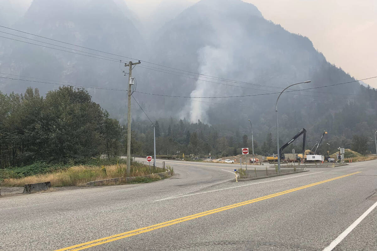
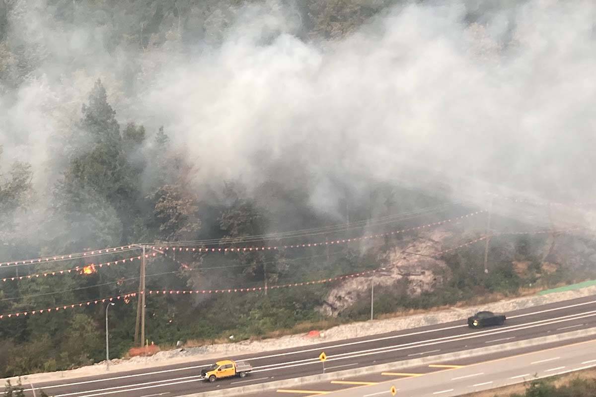
All eastbound traffic detoured to Highway 7 and Highway 9 Sunday

Highway 1 eastbound through Hope is closed Sunday (Sept. 11) as the Flood Falls Trail wildfire continues to grow. (Photo courtesy of BC Wildfire Service)
Wildfire officials in British Columbia say they are working with BC Parks and the Transportation Ministry to prepare for the spread of a blaze that has already charred 19 square kilometres of bush in Manning provincial park, as shown in this recent handout image provide by the BC Wildfire Service. THE CANADIAN PRESS/HO-BC Wildfire Service

Crews keep close watch on one B.C. wildfire, as another delays school in northeast

Manning Park, Hudson’s Hope home to notable blazes

Wildfire officials in British Columbia say they are working with BC Parks and the Transportation Ministry to prepare for the spread of a blaze that has already charred 19 square kilometres of bush in Manning provincial park, as shown in this recent handout image provide by the BC Wildfire Service. THE CANADIAN PRESS/HO-BC Wildfire Service