Barbara Roden

The death of Kamloops resident Mark Hoffman, last seen on Dec. 15, is now being classified as a homicide. Hoffman’s body was found west of Highway 5 south of Kamloops on Dec. 16. (Photo credit: RCMP)

Death of Kamloops man and his dog Kamloops now classed as homicide

Kamloops resident Mark Hoffman last seen alive on Dec. 15; police seeking information from public

The death of Kamloops resident Mark Hoffman, last seen on Dec. 15, is now being classified as a homicide. Hoffman’s body was found west of Highway 5 south of Kamloops on Dec. 16. (Photo credit: RCMP)
Highway 1 at Falls Creek (Jackass Mountain) south of Spences Bridge will be open to two-way traffic as of Dec. 15, shortening travel time along the Fraser-Thompson corridor. (Photo credit: Ministry of Transportation)

Highway 1 at Falls Creek in Fraser Canyon reopens to two-way traffic

Badly damaged in November 2021 atmospheric river, site has been open to single lane traffic only

Highway 1 at Falls Creek (Jackass Mountain) south of Spences Bridge will be open to two-way traffic as of Dec. 15, shortening travel time along the Fraser-Thompson corridor. (Photo credit: Ministry of Transportation)
Ashcroft Terminal and the Vancouver Fraser Port Authority have signed a letter of intent to invest in, build, and operate rail infrastructure at Ashcroft Terminal to reduce congestion within the Port of Vancouver. (Photo credit: Ashcroft Terminal)

Ashcroft Terminal upgrade aimed at unclogging B.C. supply chain congestion

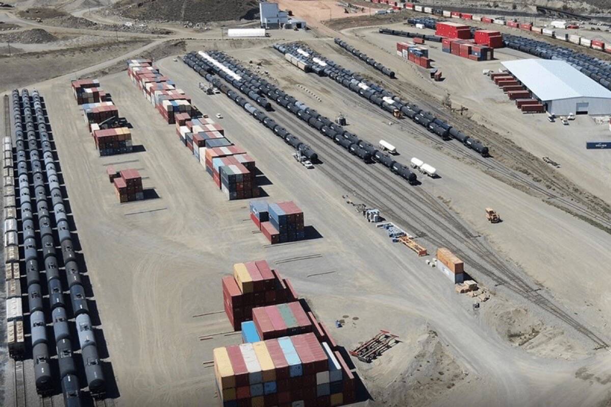
Ashcroft Terminal, Port of Vancouver to work together to reduce congestion within Port of Vancouver

Ashcroft Terminal and the Vancouver Fraser Port Authority have signed a letter of intent to invest in, build, and operate rail infrastructure at Ashcroft Terminal to reduce congestion within the Port of Vancouver. (Photo credit: Ashcroft Terminal)
In August 2022 part of the upcoming Apple+ TV series <em>Monarch: Legacy of Monsters</em> was filmed east of Cache Creek, and will feature in the show’s third episode, airing on Nov. 24. (Photo credit: Apple+/YouTube)

Godzilla roams B.C. Southern Interior in new Apple+ TV series

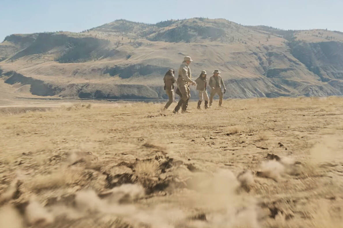
Part of ‘Monarch: Legacy of Monsters’ was filmed east of Cache Creek in 2022

In August 2022 part of the upcoming Apple+ TV series <em>Monarch: Legacy of Monsters</em> was filmed east of Cache Creek, and will feature in the show’s third episode, airing on Nov. 24. (Photo credit: Apple+/YouTube)
Teddy and Indy are new arrivals at the Honour Ranch, and will be part of the equine program offered there. (Photo credit: Barbara Roden)

How a $10,000 toque is helping horses heal B.C.’s hurt heroes

Honour Ranch near Ashcroft set to offer equine therapy program to help first responders

Teddy and Indy are new arrivals at the Honour Ranch, and will be part of the equine program offered there. (Photo credit: Barbara Roden)
Aerial view of the proposed new Highway 97 crossing at the Dairy Queen (building at bottom centre), as well as two additional crossings of Cache Creek further upstream (at Quartz Road and at the Cache Creek Motor Inn). (Photo credit: Ministry of Transportation)

B.C. to build new flood-proof bridge on Highway 97 in Cache Creek

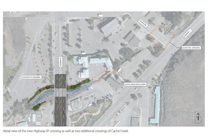
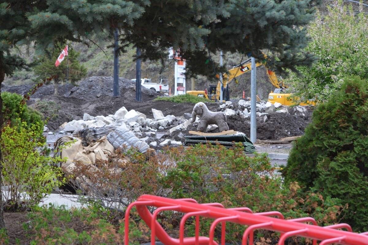
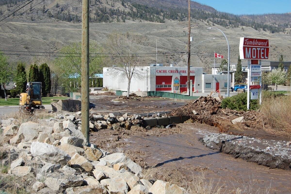
Bridge will replace culvert beside Dairy Queen that contributed to 2023 flooding

Aerial view of the proposed new Highway 97 crossing at the Dairy Queen (building at bottom centre), as well as two additional crossings of Cache Creek further upstream (at Quartz Road and at the Cache Creek Motor Inn). (Photo credit: Ministry of Transportation)
Wild horses near a highway in the South Okanagan. Police are still seeking information from the public regarding the killing of 17 wild horses west of Kamloops earlier this year. (Photo credit: Black Press file photo)

RCMP still seeking information about killing of wild horses in Southern Interior

17 Skeetchestn traditional horses were found dead west of Kamloops in early March

Wild horses near a highway in the South Okanagan. Police are still seeking information from the public regarding the killing of 17 wild horses west of Kamloops earlier this year. (Photo credit: Black Press file photo)
Flooding in Cache Creek Park on May 10. Water levels are receding, but the park remains closed to prevent damage. (Photo credit: Tim Gross)

Some evacuation orders rescinded as flood threat recedes in Cache Creek

Bonaparte River water levels dropping but Sage and Sands Trailer Park still on evacuation order

Flooding in Cache Creek Park on May 10. Water levels are receding, but the park remains closed to prevent damage. (Photo credit: Tim Gross)
A child’s toy, presumably washed down by floodwater, sits atop a pile of unused Hesco baskets outside the Cache Creek fire hall. (Photo credit: Barbara Roden)

Dozens of Cache Creek properties on evacuation order as Bonaparte River rises

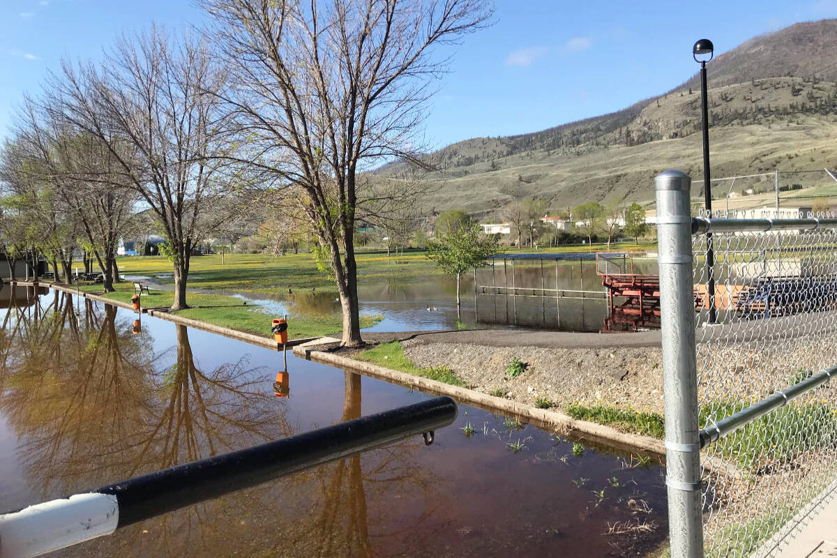
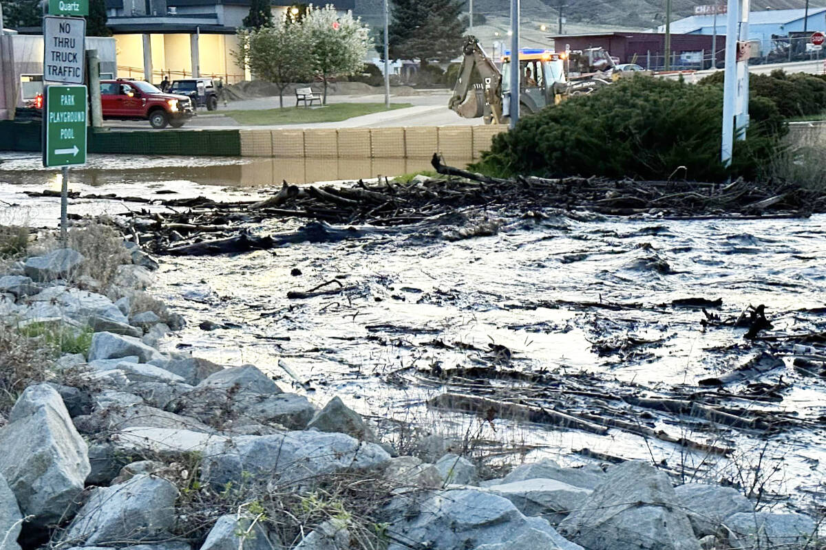
Flood-ravaged community braces for more flooding as temperatures set to rise

A child’s toy, presumably washed down by floodwater, sits atop a pile of unused Hesco baskets outside the Cache Creek fire hall. (Photo credit: Barbara Roden)
Highway 97 in Cache Creek at the junction with Highway 1 on May 2. Highways 1 and 97 have both reopened to single-lane-alternating traffic with a pilot car. (Photo credit: Sheila Olson)

Highways 1 and 97 in Cache Creek reopen to single-lane traffic

Both highways have been closed to all traffic due to heavy flooding

Highway 97 in Cache Creek at the junction with Highway 1 on May 2. Highways 1 and 97 have both reopened to single-lane-alternating traffic with a pilot car. (Photo credit: Sheila Olson)
Cache Creek overflows the culvert at Quartz Road on the evening of April 29. (Photo credit: Sheila Olson)

Flooding prompts state of local emergency in Cache Creek

One property has been placed on evacuation order

Cache Creek overflows the culvert at Quartz Road on the evening of April 29. (Photo credit: Sheila Olson)
Cache Creek overflowed the culvert at Quartz Road on the evening of April 29, prompting the village to declare a State of Local Emergency and place one property east of the site on evacuation order. (Photo credit: Barbara Roden)

Flooding prompts state of local emergency in Cache Creek

One property has been placed on evacuation order

Cache Creek overflowed the culvert at Quartz Road on the evening of April 29, prompting the village to declare a State of Local Emergency and place one property east of the site on evacuation order. (Photo credit: Barbara Roden)
A temporary one-lane bridge being built across the Nicola River at IR7 near Osprey Ranch. The highway used to follow the base of the cliff, before the atmospheric river of November 2021. (Photo credit: Geoff Bannoff)

Ranch sign swept away in B.C.’s 2021 floods found after 350 km journey

Sign lost near Spences Bridge recovered on Sunshine Coast 14 months later

A temporary one-lane bridge being built across the Nicola River at IR7 near Osprey Ranch. The highway used to follow the base of the cliff, before the atmospheric river of November 2021. (Photo credit: Geoff Bannoff)
A travel advisory is in effect for 36.2km of Highway 97 between Hills Frontage Road and Big Bar Road north of Cache Creek. (Photo credit: Google Maps)

Travel advisory on Highway 97 between Cache Creek and Clinton area

Drivers advised to avoid area due to compact ice and extremely slippery conditions

A travel advisory is in effect for 36.2km of Highway 97 between Hills Frontage Road and Big Bar Road north of Cache Creek. (Photo credit: Google Maps)
A second Ashcroft resident in severe medical distress living within half-a-block of the ambulance station has had to wait nearly 30 minutes for an ambulance to arrive, and has not survived. (Photo credit: Ashcroft <em>Journal</em> file photo)

B.C. man dies within sight of ambulance station with no paramedics available

Second time in less than a month no ambulance available in Ashcroft for person in medical distress

A second Ashcroft resident in severe medical distress living within half-a-block of the ambulance station has had to wait nearly 30 minutes for an ambulance to arrive, and has not survived. (Photo credit: Ashcroft <em>Journal</em> file photo)
The long-gone Sumallo Lodge on Highway 3 east of Hope, which played a role in the Hope Slide tragedy in January 1965, as seen in a photolog from July 21, 1966. (Photo credit: Ministry of Transportation)

Vintage video logs of B.C.’s highways a vivid trip back in time

‘Photologs’ were created in 1966, and are a window on a long-vanished world

The long-gone Sumallo Lodge on Highway 3 east of Hope, which played a role in the Hope Slide tragedy in January 1965, as seen in a photolog from July 21, 1966. (Photo credit: Ministry of Transportation)
Fire near Hat Creek Road south of Ashcroft near Highway 1. (Photo credit: Brandi Lynn Zirk)

Firefighters respond to two grass fires west of Highway 1 near Ashcroft

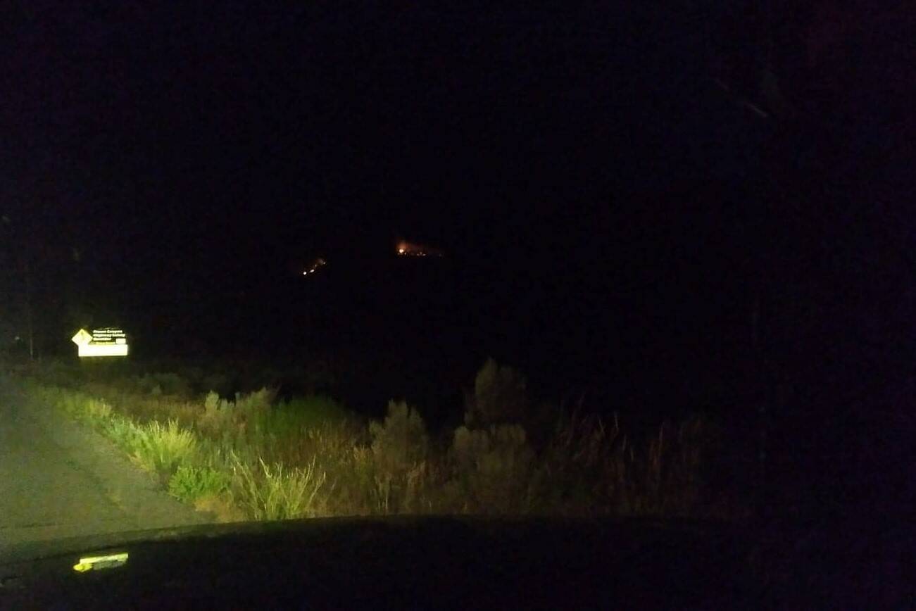
The fires, near Hat Creek Road started after thunderstorm rolled through

  • Jul 28, 2022
Fire near Hat Creek Road south of Ashcroft near Highway 1. (Photo credit: Brandi Lynn Zirk)
Joel Anstett, with his dog Apollo, shows some of the injuries he suffered while fighting off a bobcat that was attacking Apollo in the back yard of their Ashcroft home on July 20. (Photo credit: Submitted)

B.C. man injured protecting dog from backyard bobcat attack

‘I think anyone else would have done the same thing’ says Joel Anstett after frightening encounter

Joel Anstett, with his dog Apollo, shows some of the injuries he suffered while fighting off a bobcat that was attacking Apollo in the back yard of their Ashcroft home on July 20. (Photo credit: Submitted)
Chad Goldney (l) and Olivia Hughes with Sunshine and her new puppies on June 23, 2022. (Photo credit: Submitted)

Puppy love: Lytton wildfire crew gets paws-itively delightful surprise

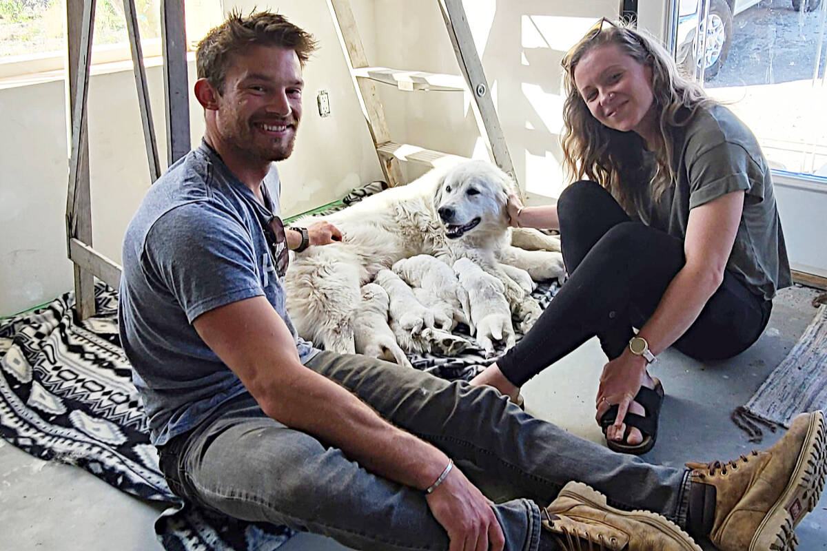
Puppies with a powerful connection to Lytton firefighters make special appearance at base camp

Chad Goldney (l) and Olivia Hughes with Sunshine and her new puppies on June 23, 2022. (Photo credit: Submitted)
The fire viewed from the north up the Fraser River. (BC Wildfire Service photo)

Crews move to protect heritage park as wildfire near Lytton grows to over 2,000 hectares

Fire is burning through difficult terrain and threatening Stein Valley Nlaka’pamux Heritage Park

The fire viewed from the north up the Fraser River. (BC Wildfire Service photo)